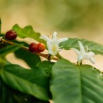


This scalable technique can be applied in any coffee-growing region, paving the way for public policies, rural credit access, and climate adaptation practices. Photo: Taya Parreiras
AI-driven remote sensing maps small coffee farms with high precision
|
Researchers have developed an unprecedented method for mapping coffee plantations via remote sensing with unparalleled sensitivity and specificity. This technique achieved over 95% accuracy by combining time-series images from the Harmonized Landsat Sentinel-2 (HLS) program with artificial intelligence algorithms, such as Random Forest and XGBoost.
In addition to identifying coffee-growing regions, the study classified the crop's four phenological stages — planting, production, pruning, and renewal — with 77% to 95% accuracy, even in areas with small, fragmented properties. This scalable technique can be applied to any coffee-growing region, paving the way for public policies, rural credit access, and climate adaptation practices in producing areas.

"The major challenge for remote sensing is mapping these highly productive regions with greater detail and precision, especially those with small- to medium-scale production. Large-scale mappings usually leave smaller areas invisible", explains Édson Bolfe, a researcher at Embrapa Digital Agriculture (SP) analyst "Using AI algorithms like this one allows us to identify these areas and bring greater precision to satellite-based mapping. This enables a better understanding of regional dynamics associated with agricultural expansion, intensification, and diversification", says Bolfe, emphasizing that these advanced digital technologies support decision-making in both the public and private sectors.
The study was carried out in the municipality of Caconde, São Paulo, one of the Agrotechnological Districts of the Semear Digital project. The productive sector itself requested the study because it lacked precise data on the area occupied by local coffee farming and its different phenological stages. Semear Digital (ver quadro no fim da matéria). A demanda surgiu do próprio setor produtivo, que sentia a falta de dados mais precisos sobre a área ocupada pela cafeicultura local e os seus diferentes estágios fenológicos.
We have the number of properties and coffee growers registered with the Federal Revenue Service. But we never effectively had the actual area of the plantations. It was mostly guesswork," says Ademar Pereira, president of the Caconde Rural Union. "Now, we have an important reference with which to advocate for public policies, guide training programs, and identify areas for coffee plantation renewal and the adoption of more modern management practices, such as skeleton pruning," Pereira evaluates.
How the method worksThe research used a dense time series of multispectral bands, spectral indices, and texture metrics derived from combined Landsat and Sentinel-2 (HLS) satellite images. The approximate image frequency was three days. The data were analyzed using AI algorithms such as Random Forest and XGBoost. A hierarchical classification system was used across four levels. The first level distinguished between native vegetation and agricultural areas. The second level distinguished between perennial crops, annual crops, and pastures. The third level differentiated coffee plantations from eucalyptus stands. The fourth level classified coffee plantations as either formation areas (up to three years old), production areas, areas with skeleton pruning, or crops undergoing renewal via stumping (pruning at the base of the plant).
Accuracy exceeded 96% in the first three levels. With increased complexity in the fourth level, accuracy dropped to an average of 83%, though it still performed well, especially in the production class, at 94%. Renewal pruning was the category with the lowest accuracy, at 78%. "From a satellite imagery perspective, coffee in the production phase resembles certain fruit crops, such as citrus. When recently planted, it can be mistaken for pasture areas," explains Taya Parreiras, a doctoral candidate at the University of Campinas (Unicamp) and a Semear Digital project scholarship recipient.Unicamp) e bolsista do projeto Semear Digital Taya Parreiras. The research revealed that indices such as NDVI, GNDVI, NDWI, and SAVI are the most effective for characterizing coffee, particularly during the rainy season when critical phenological transitions occur. The HLS green band was particularly important, accounting for nearly 40% of the Level 2 classification. GLCM texture metrics and land surface temperature (LST) data helped refine the results, particularly in distinguishing between productive and skeleton-pruned coffee fields. While the Random Forest and XGBoost AI systems achieved similar accuracy, Random Forest was more efficient in data processing, being up to 15 times faster than XGBoost. According to the study's authors, this difference is negligible in smaller analyses, such as those covering a single municipality, but it becomes significant in analyses covering larger territories. |


Helping coffee in the face of climate change
This technological breakthrough comes at a critical time. Coffee is one of the crops most affected by climate change, which is expected to reduce the amount of land suitable for planting in Latin America, Africa, and Asia.
"In a climate change scenario where precise coffee management is critical for sustainability and competitiveness, this methodology puts Brazil at the forefront of digital agricultural monitoring. It allows us to map and understand the dynamics of the coffee cycle. This provides a robust tool to guide adaptation policies, ensure traceability for international markets, and most importantly, support producers in decision-making, especially those with small properties that were previously virtually invisible in conventional mappings," says Gustavo Bayma, an Embrapa Environment (SP) analyst .
The developers predict that the new system will strengthen agricultural governance in Brazil by providing a scalable, transparent, and accessible tool. This will expand producers' access to credit and insurance, support climate adaptation policies, and ensure greater confidence from consumers and international markets in production traceability.
Next steps
All developed maps and generated data are available for free on the Embrapa Research Data Repository (Redape).
Researchers plan to expand testing to multi-year series and improve accuracy in less represented classes, such as renewal.
"We are developing models to delineate field plots because we observed confusion when separating pathways, dirt roads, and forest areas. The idea is to use a deep learning model to accurately delineate plots using high-resolution images," explains Taya Parreiras.
The goal is for the system to become an operational tool for public agencies, cooperatives, unions, and producers. This will allow Brazil to maintain its position of leadership in the global coffee market while strengthening the sustainability of the sector.
Published results:The research results were published in the scientific journal Remote Sensing. The article, "Dense Time Series of Harmonized Landsat Sentinel-2 and Ensemble Machine Learning to Map Coffee Production Stages," can be accessed for free here. In addition to the Embrapa and Unicamp teams, researchers from Nasa and the State University of Paraíba (UEPB) were also involved in the work. |
O projeto Semear DigitalThe remote sensing mapping of coffee plantations in Caconde, São Paulo, is part of the Science for Development Center in Digital Agriculture's activities, also known as Semear Digital. Coordinated by Embrapa Digital Agriculture and funded by the São Paulo Research Foundation ( FAPESP), the initiative aims to provide small- and medium-sized rural producers with digital technologies and connectivity solutions. The project has established ten Agrotechnological Districts (DATs) in various regions of Brazil, including Caconde. In each location, a multidisciplinary team from Embrapa and partner institutions has conducted a diagnosis and is developing research and technology transfer actions tailored to local needs. |
Gabriel Faria (MTb 15.624/MG)
Embrapa Digital Agriculture
Press inquires: agricultura-digital.imprensa@embrapa.br
This text was translated with the assistance of artificial intelligence (DeepL and DeepSeek) and reviewed by Érica Speglich